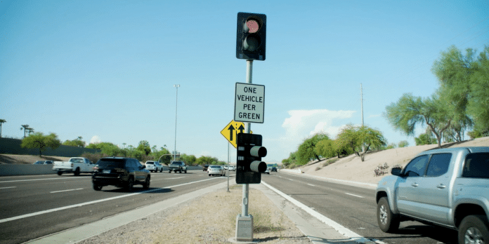
The Arizona Department of Transportation (ADOT) continues to upgrade the Phoenix area’s network of adaptive freeway ramp meters used to improve the flow of traffic, especially during busy rush hours.
The improvements have not required the installation of new ramp meters. ADOT has instead used enhanced computer programming to operate the timing of the meters’ alternating green and red traffic lights to provide valuable space between vehicles entering a freeway.
Ramp meter upgrades were completed this year along the 60 miles of Loop 101 in the Phoenix area – from near I-10 in the West Valley all the way around to Loop 202 (Santan Freeway) in Chandler.
Adaptive ramp metering was first tested with positive results in 2019 along State Route 51 in Phoenix, followed by stretches of I-10 and I-17. Approximately 75 percent of the more than 250 ramp meters along Valley freeways now operate using the upgraded system.
The improvements mean each ramp meter can now respond to traffic conditions farther away from any one specific freeway location.
For example, an adaptive ramp meter is able to respond to slowing or improved traffic conditions beyond its immediate on-ramp location. Data about conditions a mile ahead along the freeway allows the meter to adjust the timing of its green and red lights. This process can be repeated along several miles of a freeway until traffic conditions improve.
Ramp meters help balance the overall amount of traffic along a freeway to enhance traffic flow. From a safety standpoint, the room between vehicles entering a freeway can enhance merging conditions and reduce the risk of crashes.
Adaptive ramp meters also have been set at times to operate outside of traditional weekday rush hours to help manage traffic flow when nearby sporting events, concerts and even weekend construction closures are taking place.
ADOT will continue to expand the use of adaptive ramp metering to additional sections of freeway in stages over time.
What’s happening on Interstate 10 RIGHT NOW! I-10 Real-time traffic information for selected cities along I-10. Maps show updates on road construction, traffic accidents, travel delays and the latest traffic speeds. Traffic cameras show congestion at a glance. Visit I-10 Traffic.
The I-10 Exit Guide is the Internet’s largest and most complete website dedicated to Interstate 10 travelers. Find detailed exit service listings… lodging, camping, food, gas and more for every exit from California to Florida!
On the road? Why not take us with you. The I-10 Exit Guide is mobile-friendly and totally FREE. No App Required.
Traveling another route? Visit our growing family of exit guides: I-4 Exit Guide, I-5 Exit Guide, I-10 Exit Guide, I-75 Exit Guide, I-80 Exit Guide and I-95 Exit Guide. Detailed exit service listings… discount lodging, camping, food, gas and more for every exit along the way!


